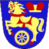
Rozvadov
Rozvadov | |
|---|---|
Municipality | |
 Rozvadov-Waidhaus border crossing | |
| Coordinates: 49°39′38″N 12°32′50″E / 49.66056°N 12.54722°E | |
| Country | |
| Region | Plzeň |
| District | Tachov |
| Area | |
| • Total | 54.88 km2 (21.19 sq mi) |
| Elevation | 570 m (1,870 ft) |
| Population (2011) | |
| • Total | 782 |
| • Density | 14/km2 (37/sq mi) |
| Postal code | 348 07 |
| Website | http://www.rozvadov.cz |
Rozvadov (German: Roßhaupt) is a village and municipality (obec) in Tachov District in the Plzeň Region of the Czech Republic, on the border with Germany.
The municipality covers an area of 54.88 square kilometres (21.19 sq mi), and has a population of 821 (as at 28 August 2006).
Rozvadov lies approximately 17 kilometres (11 mi) south of Tachov, 61 km (38 mi) west of Plzeň, and 143 km (89 mi) west of Prague.
King's Casino Rozvadov is located in the village and currently contains the largest poker room in Europe.[1][2]
Rozvadov.com is a domain of the same name, at the moment not active.[3]
See also
References
- ^ Pitt, Matthew (2012-05-24). "Introducing The King's Casino Rozvadov: The Largest Poker Room In Europe". PokerNews. Retrieved 29 December 2018.
- ^ Glatzer, Jason (2018-10-01). "History of the WSOP Europe Part I: The London Years". PokerNews. Retrieved 29 December 2018.
- ^ Marasov, Please let me know if you have any questions. "Rozvadov.com".
Notes
Wikimedia Commons has media related to Rozvadov.


