
Cobbtown, Georgia
Cobbtown, Georgia | |
|---|---|
 Location in Tattnall County and the state of Georgia | |
| Coordinates: 32°16′53″N 82°8′18″W / 32.28139°N 82.13833°W | |
| Country | United States |
| State | Georgia |
| County | Tattnall |
| Area | |
| • Total | 0.68 sq mi (1.76 km2) |
| • Land | 0.67 sq mi (1.73 km2) |
| • Water | 0.01 sq mi (0.03 km2) |
| Elevation | 246 ft (75 m) |
| Population (2010) | |
| • Total | 351 |
| • Estimate (2019)[2] | 357 |
| • Density | 533.63/sq mi (206.11/km2) |
| Time zone | UTC-5 (Eastern (EST)) |
| • Summer (DST) | UTC-4 (EDT) |
| ZIP code | 30420 |
| Area code | 912 |
| FIPS code | 13-17272[3] |
| GNIS feature ID | 0355208[4] |
Cobbtown is a city in Tattnall County, Georgia, United States. The population was 311 at the 2000 census.
History
A variant name was "Corsica".[5] The Georgia General Assembly incorporated the place as the "Town of Cobbtown" in 1905.[6]
Geography
Cobbtown is located at 32°16′53″N 82°8′18″W / 32.28139°N 82.13833°W (32.281376, -82.138288).[7]
According to the United States Census Bureau, the city has a total area of 0.7 square miles (1.8 km2), all of it land.
Demographics
| Census | Pop. | Note | %± |
|---|---|---|---|
| 1910 | 254 | — | |
| 1920 | 325 | 28.0% | |
| 1930 | 295 | −9.2% | |
| 1940 | 275 | −6.8% | |
| 1950 | 88 | −68.0% | |
| 1960 | 2,802 | 3,084.1% | |
| 1970 | 321 | −88.5% | |
| 1980 | 494 | 53.9% | |
| 1990 | 338 | −31.6% | |
| 2000 | 311 | −8.0% | |
| 2010 | 351 | 12.9% | |
| 2019 (est.) | 357 | [2] | 1.7% |
| U.S. Decennial Census[8] | |||
As of the census[3] of 2000, there were 311 people, 139 households, and 91 families residing in the city. The population density was 459.7 people per square mile (176.6/km2). There were 178 housing units at an average density of 263.1 per square mile (101.1/km2). The racial makeup of the city was 86.82% White, 9.65% African-American, 0.32% Native American, 3.22% from other races. Hispanic or Latino of any race were 3.54% of the population.
There were 139 households, out of which 23.7% had children under the age of 18 living with them, 48.2% were married couples living together, 13.7% had a female householder with no husband present, and 34.5% were non-families. 31.7% of all households were made up of individuals, and 20.1% had someone living alone who was 65 years of age or older. The average household size was 2.24 and the average family size was 2.78.
In the city, the population was spread out, with 21.2% under the age of 18, 7.7% from 18 to 24, 22.2% from 25 to 44, 22.5% from 45 to 64, and 26.4% who were 65 years of age or older. The median age was 44 years. For every 100 females, there were 92.0 males. For every 100 females age 18 and over, there were 76.3 males.
The median income for a household in the city was $23,571, and the median income for a family was $31,250. Males had a median income of $25,982 versus $16,875 for females. The per capita income for the city was $14,646. About 10.5% of families and 12.7% of the population were below the poverty line, including 10.0% of those under age 18 and 23.1% of those age 65 or over.
References
- ^ "2019 U.S. Gazetteer Files". United States Census Bureau. Retrieved July 9, 2020.
- ^ a b "Population and Housing Unit Estimates". United States Census Bureau. May 24, 2020. Retrieved May 27, 2020.
- ^ a b "U.S. Census website". United States Census Bureau. Retrieved 2008-01-31.
- ^ "US Board on Geographic Names". United States Geological Survey. 2007-10-25. Retrieved 2008-01-31.
- ^ Krakow, Kenneth K. (1975). Georgia Place-Names: Their History and Origins (PDF). Macon, GA: Winship Press. p. 47. ISBN 0-915430-00-2.
- ^ Acts and Resolutions of the General Assembly of the State of Georgia. Clark & Hines, State Printers. 1905. p. 732.
- ^ "US Gazetteer files: 2010, 2000, and 1990". United States Census Bureau. 2011-02-12. Retrieved 2011-04-23.
- ^ "Census of Population and Housing". Census.gov. Retrieved June 4, 2015.
Municipalities and communities of Tattnall County, Georgia, United States | ||
|---|---|---|
| Cities | 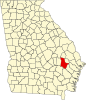 | |
| CDP | ||
| Unincorporated community | ||
| Ghost town | ||