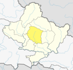
Ribhan
Appearance
Ribhan
रिभान | |
|---|---|
Village Development Committee | |
| Coordinates: 28°20′N 83°55′E / 28.34°N 83.91°E | |
| Country | |
| Zone | Gandaki Zone |
| District | Kaski District |
| Population (2001) | |
• Total | 1,617 |
| Time zone | UTC+5:45 (Nepal Time) |
Ribhan (रिभान, transcribed also as "'Reevan'" and "'Rivan'") is a village and Village Development Committee in Kaski District in the Gandaki Zone of northern-central Nepal. At the time of the 2001 Nepal census it had a population of 1,617 persons living in 372 individual households. Brahmin and Gurung are main ethnic groups in this village. Ribhan is mainly in the bank of Mardi river which is main source of irrigation for people of this agriculture-based village. The forest in this village has many endangered species such as Himali red panda and leopard. Much of its forest is still unexplored as it is very remote with high hills and sometimes snow. It is a part of Annapurna Conservation Area project .[1]
References
- ^ "Nepal Census 2001". Nepal's Village Development Committees. NAVIN. Retrieved 25 June 2011.
External links


