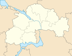
Obukhivka
Appearance
Obukhivka
Обухівка | |
|---|---|
Urban-type settlement | |
| Coordinates: 48°32′36″N 34°51′32″E / 48.54333°N 34.85889°E | |
| Country | Ukraine |
| Oblast | Dnipropetrovsk Oblast |
| Raion | Dnipro Raion |
| Population (2019) | |
| • Total | 9,178[1] |
| Time zone | UTC+2 (EET) |
| • Summer (DST) | UTC+3 (EEST) |
Obukhivka (Ukrainian: Обухівка; Russian: Обуховка) is an urban-type settlement in Dnipro Raion of Dnipropetrovsk Oblast in Ukraine. Until 2016, the settlement was known as Kirovske. It was renamed Obukhivka by Verkhovna Rada according to the law prohibiting names of Communist origin.[2] Obukhivka is a suburb of Dnipro and is located on the left bank of the Dnieper. Population: Template:Ua-pop-est2019
Economy
Transportation
The closest passenger railway station is in Dnipro.
Obukhivka is on Highway H31 which connects Dnipro and Reshetylivka.
References
- ^ Cite error: The named reference
ua2019estimatewas invoked but never defined (see the help page). - ^ "Что еще переименовали на Днепропетровщине: 2 города, 1 район, 67 сел и 6 поселков". 34.ua (in Russian). 15 May 2016.

