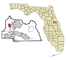
Heathrow, Florida
Heathrow, Florida | |
|---|---|
 Location in Seminole County and the state of Florida | |
| Coordinates: 28°46′22″N 81°22′17″W / 28.77278°N 81.37139°W | |
| Country | |
| State | |
| County | Seminole |
| Area | |
• Total | 3.3 sq mi (9 km2) |
| • Land | 2.8 sq mi (7 km2) |
| • Water | 0.5 sq mi (1 km2) |
| Elevation | 49 ft (15 m) |
| Population (2010) | |
• Total | 5,896 |
| • Density | 1,800/sq mi (690/km2) |
| Time zone | UTC-5 (Eastern (EST)) |
| • Summer (DST) | UTC-4 (EDT) |
| ZIP code | 32746 |
| Area code(s) | 407, 689 |
| FIPS code | 12-29320[1] |
| GNIS feature ID | 0294456[2] |
Heathrow is a census-designated place and an unincorporated suburban community in Seminole County, Florida, United States. Heathrow is on the I-4 Corridor in Central Florida, 19 miles northeast of Orlando and 38 miles southwest of Daytona Beach. Heathrow comprises a master-planned, private gated residential community of approximately 2,200 homes, and the Heathrow International Business Center, an office park. Heathrow was founded in 1985 by Jeno Paulucci, a food business entrepreneur. The area had been a source of celery used in making his Chun King Foods American Chinese style food. The population was 4,068 at the 2000 census. Heathrow is home to the national headquarters of the American Automobile Association (AAA).
Heathrow is part of the Orlando–Kissimmee–Sanford Metropolitan Statistical Area.
Geography and transportation
Heathrow is located at 28°46′22″N 81°22′17″W / 28.77278°N 81.37139°W (28.772770, -81.371397).[3]
According to the United States Census Bureau, the CDP has a total area of 3.3 square miles (8.5 km2), of which 2.8 square miles (7.3 km2) is land and 0.5 square miles (1.3 km2) (16.01%) is water.
The main highway serving Heathrow is Interstate 4, which traverses the state from Daytona Beach in the east to Tampa in the west.
Demographics
As of the census[1] of 2000, there were 4,068 people, 1,770 households, and 1,258 families residing in the CDP. The population density was 1,466.6 people per square mile (567.0/km2). There were 1,961 housing units at an average density of 707.0/sq mi (273.3/km2). The racial makeup of the CDP was 89.33% White, 3.69% African American, 0.12% Native American, 4.70% Asian, 0.98% from other races, and 1.18% from two or more races. Hispanic or Latino of any race were 6.12% of the population.
There were 1,770 households, out of which 25.1% had children under the age of 18 living with them, 64.9% were married couples living together, 4.2% had a female householder with no husband present, and 28.9% were non-families. 23.5% of all households were made up of individuals, and 4.8% had someone living alone who was 65 years of age or older. The average household size was 2.30 and the average family size was 2.72.
In the CDP, the population was spread out, with 19.9% under the age of 18, 3.7% from 18 to 24, 32.5% from 25 to 44, 31.8% from 45 to 64, and 12.1% who were 65 years of age or older. The median age was 41 years. For every 100 females, there were 95.8 males. For every 100 females age 18 and over, there were 93.0 males.
The median income for a household in the CDP was $84,241, and the median income for a family was $107,479. Males had a median income of $76,790 versus $41,820 for females. The per capita income for the CDP was $59,905. About 1.4% of families and 2.1% of the population were below the poverty line, including none of those under age 18 and 6.0% of those age 65 or over.
Residential community
The Heathrow is a city residential community consists of 2061 homes in 30 different sub-developments. All of these sub-developments are part of the Heathrow Master Association. Each sub-development is also incorporated as part of its own Home Owner’s Association, or is part of an association that includes more than one sub-development.[4][5]
The following neighborhoods are part of the Heathrow residential community.
- Brampton Cove
- Bridgewater Neighborhood
- East Camden
- Bristol Park
- Chestnut Hill
- Clubside
- Devon Green
- The Hamptons
- Heathrow Lakes Maintenance Association
- Brookhaven Manor & Ridge
- Burlington Oaks
- Carrington Park
- Cherry Ridge
- Coventry
- Heron Ridge
- Keenwicke
- Kentford Gardens
- Lakeside
- Reserve At Heathrow
- Waters Edge
- Wembley Park
- Wyntree
- Muirfield Village
- Muirfield Village
- Breckenridge Heights
- Lexington Green
- Regency Green
- Regency Green
- Stratford Gardens
- Racquet Club Villas
- Stonebridge
- Turnberry
- Westover (Bridgewater Club)
- Willowbrook
Notable people
- Lee Corso, ESPN personality
- Chris DiMarco, professional golfer
- Dwight Howard, professional basketball player
- Cliff Kresge, professional golfer
- Tim Raines, baseball player
- Tim Raines, Jr., baseball player
Economy
Heathrow is the national headquarters of the American Automobile Association (AAA).[6]
References
- ^ a b "U.S. Census website". United States Census Bureau. Retrieved 2008-01-31.
- ^ "US Board on Geographic Names". United States Geological Survey. 2007-10-25. Retrieved 2008-01-31.
- ^ "US Gazetteer files: 2010, 2000, and 1990". United States Census Bureau. 2011-02-12. Retrieved 2011-04-23.
- ^ Community, Heathrow. "Heathrow Community". heathrowcommunity.com. Retrieved 2016-11-08.
- ^ Community, Heathrow. "Heathrow Community - Access Denied". heathrowcommunity.com. Retrieved 2016-11-08.
- ^ Allen, Stephanie; Stutzman, Rene (May 8, 2015). "Man's body, pickup pulled from pond in Heathrow, FHP reports". Orlando Sentinel. Archived from the original on September 7, 2018.

