Szentes
Appearance
Szentes | |
|---|---|
 Near the center of the town with Lutheran Church | |
| Coordinates: 46°23′27″N 20°09′09″E / 46.3907°N 20.1526°E | |
| Country | |
| County | Csongrád |
| District | Szentes |
| Area | |
| • Total | 353.25 km2 (136.39 sq mi) |
| Population (2015) | |
| • Total | 27,898 |
| • Density | 79/km2 (200/sq mi) |
| Time zone | UTC+1 (CET) |
| • Summer (DST) | UTC+2 (CEST) |
| Postal code | 6600 |
| Area code | (+36) 63 |
| Website | www |
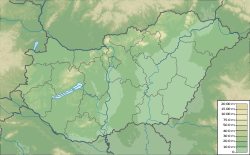
Szentes is a town in south-eastern Hungary, Csongrád county. It's near to the Tisza river. The town is a cultural and educational center of the region.
Notable people
- Árpád Balázs (born 1937), classical music composer
- János Bácskai 1954. november 27, actor
- János Berkes (born 1946 May 24) opera singer (tenor)
- István Bugyi (1898-1981) surgeon - The local hospital named after him
- Jozsef Gera (born 1937) aircraft engineer, former chief of the Dynamics and Controls Branch at NASA
- László Gyimesi (born 1948), pianist
- Mihály Horváth (1809–1878), Roman Catholic bishop
- Tamás Kecskés (born 1986), footballer
- Zsolt Koncz (born 1977), footballer
- László Márkus (1881-1948), drama author, director, member of the Hungarian Opera
- András Mészáros (born 1941), former cyclist
- Ibolya Nagy (1864–1946), actress
- Lajos Őze (1935–1984), actor
- László Papp (1905–1989), wrestler
- Zoltán Puskás (born 1993), footballer
- István Szelei (born 1960), fencer
- Konrád Verebélyi (born 1995), footballer
- Zséda (born 1974), singer
- László Terney (1947-1998) architect
- László Ujréti (born 1942) actor, voice actor
- Péter Szalay (born 1962), quantum chemist, theoretical chemist
International relations
Twin towns — Sister cities
Szentes is twinned with:
 Bačka Topola, Serbia
 Buñol, Spain
 Dumbrăvița, Romania
 Hof Ashkelon, Israel
 Kaarina, Finland
 Markgröningen, Germany
 Sankt Augustin, Germany
 Skierniewice, Poland
Gallery
References
External links
Wikimedia Commons has media related to Szentes.
- Official website in Hungarian, English, German and Serb
- Városi Visszhang - Szentes
- Local Radio Station - Radio 451
46°39′07″N 20°15′26″E / 46.6519444544°N 20.2572222322°E


