Drevlians Nature Reserve
| Drevlians Nature Reserve | |
|---|---|
| Template:Lang-uk | |
 Drevylans Nature Reserve | |
| Location | Zhytomyr Oblast, Narodychi Raion |
| Nearest city | Narodychi |
| Coordinates | 51°12′10″N 29°04′53″E / 51.20278°N 29.08139°E |
| Area | 30,872.84 hectares (76,288 acres; 309 km2; 119 sq mi) |
| Established | 2009 |
| Governing body | Ministry of Ecology and Natural Resources (Ukraine) |
| Website | http://drevlyansky.in.ua/ |
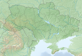
Drevlians Nature Reserve (Template:Lang-uk) is a strict nature reserve of Ukraine that follows along the Uzh River in the Polesia region of north-central Ukraine. Created to protect representative forests and wetlands of the Polesia region, the area experienced contamination from the Chernobyl disaster. The site is 80 km due west of Chernobyl. The reserve is in the administrative district of Narodychi in Zhytomyr Oblast[1]
Topography
The Polesie is a marshy region along the Prypiat River on the border between Ukraine and Belarus. The middle of the Uzh River runs along the northern border of the Drevylans Reserve, as it flows northeast to meet the Prypiat. Smaller tributaries run north through the reserve into the Uzh. The terrain is flat. The site is roughly rectangular, measuring about 15 kilometres (9.3 mi) by 25 kilometres (16 mi).

Climate and ecoregion
The climate of Drevlians is Humid continental climate, warm summer (Köppen climate classification (Dfb)). This climate is characterized by large seasonal temperature differentials and a warm summer (at least four months averaging over 10 °C (50 °F), but no month averaging over 22 °C (72 °F).[2][3]
The reserve is located in the Central European mixed forests ecoregion, a temperate hardwood forest covering much of northeastern Europe, from Germany to Russia.[4]
Flora and fauna
Over half of the reserve is forested, with pine, oak, alder, birch, ash, aspen, and hornbeam dominating.[5] Over 800 species of vascular plants have been recorded in the reserve, representing 56% of the species in the Ukrainian Polesi.
Public use
As a strict nature reserve, Drevlians's primary purpose is protection of nature and scientific study. Public access is limited: mass recreation and construction of facilities is prohibited as are hunting and fishing. Reserve staff conduct ecological excursions and educational sessions for local school children, and the scientific department hosts visiting researchers.[1]
See also
- Lists of Nature Preserves of Ukraine (class Ia protected areas)
- National Parks of Ukraine (class II protected areas)
References
- ^ a b "Drevylans Nature Reserve" (in Ukrainian). Official Reserve Website. Retrieved June 18, 2019.
- ^ Kottek, M., J. Grieser, C. Beck, B. Rudolf, and F. Rubel, 2006. "World Map of Koppen-Geiger Climate Classification Updated" (PDF). Gebrüder Borntraeger 2006. Retrieved September 14, 2019.
{{cite web}}: CS1 maint: multiple names: authors list (link) CS1 maint: numeric names: authors list (link) - ^ "Dataset - Koppen climate classifications". World Bank. Retrieved September 14, 2019.
- ^ "Map of Ecoregions 2017". Resolve, using WWF data. Retrieved September 14, 2019.
- ^ "Drevlians Nature Reserve - Borders" (in Ukrainian). Official Reserve Website. Retrieved June 18, 2019.


