
Nazdik Singaram
Nazdik Singaram | |
|---|---|
Village | |
| Country | |
| State | Andhra Pradesh |
| Government | |
| • Sarpanch | Vannavada Aruna |
| Languages | |
| • Official | Telugu |
| Time zone | UTC+5:30 (IST) |
| Telephone code | 040 |
| Vehicle registration | AP 26 X XXXX |
Nazdik Singaram is a village in Ranga Reddy district in Andhra Pradesh, India. It falls under Yacharam mandal. The village is undergoing transformation with the active participation of the youth and the guidance of the senior citizens. The basic source of living is the agriculture and dairy. The villagers are into various sectors like electronic media, IT industry, and Pharmaceutical industry.
History
This section is empty. You can help by adding to it. (January 2017) |
Geography
This section is empty. You can help by adding to it. (January 2017) |
Religious places
This section is empty. You can help by adding to it. (January 2017) |
Transport
This section is empty. You can help by adding to it. (January 2017) |
Politics
This section is empty. You can help by adding to it. (January 2017) |
Leading party is congress.
Renowned public leader Mohammed Shoyeb.
Schools
This section is empty. You can help by adding to it. (January 2017) |
Agriculture
This section is empty. You can help by adding to it. (January 2017) |
Images
Shramadhanam August 2013
-
 Shramadhanam August 10, 2013

Independence Day 2013
-
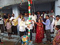 Flag Hoisting
 -
 Bharath Matha
 -
 Gandhiji


Panoramic view
References
17°02′N 78°36′E / 17.033°N 78.600°E