
Abiskojokk
| Abiskojokk Abiskojåkka, Ábeskoeatnu | |
|---|---|
 | |
| Location | |
| Country | Sweden |
| County | Norrbotten |
| Municipality | Kiruna |
| Physical characteristics | |
| Mouth | Torneträsk |
• coordinates | 68°22′N 18°47′E / 68.367°N 18.783°E |
| Length | 40 km (25 mi)[1] |
| Basin size | 544 km2 (210 sq mi)[1] |
Abiskojokk or Abiskojåkka (Northern Sami: Ábeskoeatnu) is a river in the Abisko National Park in northern Sweden. The upper part of the river is called Kamajokk or Kamajåkka.
-
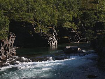 Abiskojokk in August 2008
 -
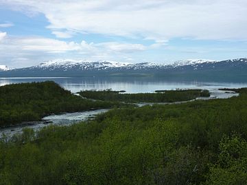 Abiskojåkka river and Torneträsk lake (Abisko national park) in June


References
- ^ a b "Abiskojokk". Nationalencyklopedin (in Swedish). Retrieved 14 August 2010. (subscription required)