Romulo Highway
| Romulo Highway | ||||
|---|---|---|---|---|
| National Highway 13 Tarlac–Pangasinan Road | ||||
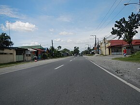
 The highway in San Pablo, Tarlac City | ||||
| Route information | ||||
| Length | 77.2 km (48.0 mi) | |||
| Component highways | ||||
| Major junctions | ||||
| Southeast end | ||||
| ||||
| Northwest end | ||||
| Location | ||||
| Country | Philippines | |||
| Provinces | Tarlac, Pangasinan | |||
| Major cities | Tarlac City | |||
| Towns | Santa Ignacia, Camiling, San Clemente, Mangatarem, Aguilar, Bugallon, Lingayen | |||
| Highway system | ||||
| ||||
| ||||
The Romulo Highway or Tarlac–Pangasinan Road, (formerly the National Highway 13) is a 77.2-kilometer (48.0 mi) major highway in the Philippines that connects the provinces of Tarlac and Pangasinan.
The highway is named after Filipino diplomat, politician, soldier, journalist and author Carlos P. Romulo, who had served, among other things, as President of the United Nations General Assembly from 1949–1950. Romulo was born in town of Camiling, Tarlac, through which the highway passes.
The entire road forms part of National Route 55 (N55) of the Philippine highway network.

