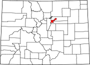
Hampden South, Denver
Hampden South is a neighborhood in Denver, Colorado, United States.
-
Hampden South Location
History & Development
Much of the land was acquired by homesteader Rufus Clark in the 1860s, who amassed his fortune growing and selling potatoes to the influx of miners looking to make fortunes in the regional gold rush. [1] The neighborhood was annexed by the City of Denver in the 1960s and subsequently developed into a suburban neighborhood.
Today the neighborhood consists largely of 1960s-1970s era homes on some of the larger lots found in the City. Three large parks also punctuate the neighborhood: Southmoor, Rosamond, and Eastmoor, and nearby Cherry Creek State Park extends just to the east.
Demographics
As of 2017, its population was 15,603 and had a median individual income of $41,650.[2]
Businesses
Sumitomo Corporation operates its Denver office in Suite 720 at 8055 East Tufts Avenue.[3]
References
- ^ "Hampden South | Community Facts". denvermetrodata.org. Retrieved 2020-04-29.
- ^ "Hampden South Neighborhood Profile Fact Sheet" (PDF). City-Data. Retrieved 8 April 2016.
{{cite web}}: CS1 maint: url-status (link) - ^ "Office Network Archived 2009-02-01 at the Wayback Machine." Sumitomo Corporation. Retrieved on January 26, 2009.

