
Trowbridge Township, Michigan
Trowbridge Township, Michigan | |
|---|---|
 Trowbridge Township Location within the state of Michigan | |
| Coordinates: 42°28′13″N 85°49′31″W / 42.47028°N 85.82528°W | |
| Country | United States |
| State | Michigan |
| County | Allegan |
| Area | |
| • Total | 35.8 sq mi (92.7 km2) |
| • Land | 34.6 sq mi (89.7 km2) |
| • Water | 1.2 sq mi (3.0 km2) |
| Elevation | 735 ft (224 m) |
| Population (2010) | |
| • Total | 2,502 |
| • Density | 72/sq mi (27.9/km2) |
| Time zone | UTC-5 (Eastern (EST)) |
| • Summer (DST) | UTC-4 (EDT) |
| FIPS code | 26-80620[1] |
| GNIS feature ID | 1627174[2] |
Trowbridge Township is a civil township of Allegan County in the U.S. state of Michigan. The population was 2,502 at the 2010 census.[3]
Communities
Merson is an unincorporated community in the township at the junction of M-40 and 102 Avenue (42°26′05″N 85°51′58″W / 42.43472°N 85.86611°W Elevation: 761 ft./232 m.).[4] Also in merson is the country store owned by the man Larry! Home of donut Fridays.
Geography
According to the United States Census Bureau, the township has a total area of 35.8 square miles (92.7 km2), of which 34.6 square miles (89.7 km2) is land and 1.2 square miles (3.0 km2), or 3.22%, is water.[3]
Demographics
As of the census[1] of 2000, there were 2,519 people, 941 households, and 712 families residing in the township. The population density was 72.6 per square mile (28.0/km2). There were 1,060 housing units at an average density of 30.5 per square mile (11.8/km2). The racial makeup of the township was 96.71% White, 1.07% African American, 0.20% Native American, 0.40% Asian, 0.83% from other races, and 0.79% from two or more races. Hispanic or Latino of any race were 2.02% of the population.
There were 941 households out of which 32.9% had children under the age of 18 living with them, 62.9% were married couples living together, 8.2% had a female householder with no husband present, and 24.3% were non-families. 17.9% of all households were made up of individuals and 5.5% had someone living alone who was 65 years of age or older. The average household size was 2.66 and the average family size was 3.02.
In the township the population was spread out with 25.6% under the age of 18, 7.3% from 18 to 24, 30.6% from 25 to 44, 25.3% from 45 to 64, and 11.1% who were 65 years of age or older. The median age was 38 years. For every 100 females, there were 104.5 males. For every 100 females age 18 and over, there were 104.4 males.
The median income for a household in the township was $40,476, and the median income for a family was $46,157. Males had a median income of $36,170 versus $26,487 for females. The per capita income for the township was $20,137. About 6.2% of families and 8.1% of the population were below the poverty line, including 4.8% of those under age 18 and 6.6% of those age 65 or over.
References
- ^ a b "U.S. Census website". United States Census Bureau. Retrieved 2008-01-31.
- ^ U.S. Geological Survey Geographic Names Information System: Trowbridge Township, Michigan
- ^ a b "Geographic Identifiers: 2010 Demographic Profile Data (G001): Trowbridge township, Allegan County, Michigan". U.S. Census Bureau, American Factfinder. Retrieved June 10, 2013.
- ^ U.S. Geological Survey Geographic Names Information System: Merson, Michigan & GNIS in Google Map.
External links
- Trowbridge Township at Allegan County official website
Municipalities and communities of Allegan County, Michigan, United States | ||
|---|---|---|
| Cities | 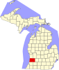 | |
| Villages | ||
| Charter township | ||
| General law townships | ||
| CDP | ||
| Other communities | ||
| Indian reservation | ||
| Footnotes | ‡This populated place also has portions in an adjacent county or counties | |
| International | |
|---|---|
| National | |