Tvøroyri Municipality
Appearance
This article needs additional citations for verification. (June 2016) |
Tvøroyri Municipality
Tvøroyrar kommuna | |
|---|---|
 | |
| Coordinates: 61°33′21″N 6°48′12″W / 61.555833°N 6.803333°W | |
| State | |
| Constituent country | |
| Islands | Suðuroy |
| Area | |
| • Total | 43 km2 (17 sq mi) |
| Population (2020) | |
| • Total | 1,714 |
| • Density | 40/km2 (100/sq mi) |
| Website | www |
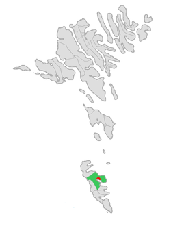
Tvøroyri Municipality (Tvøroyrar kommuna) is a municipality of the Faroe Islands with Tvøroyri as its administrative centre.[1]
The municipality is one of 7 on the island of Suðuroy and covers most of the northeast portion.[2]
It contains the following towns and villages:
Politics
Municipal council
Tvøroyri's municipal council consists of 7 members, elected every four years.
| Election | Party | Total seats |
Turnout | Elected mayor | |||||||||
|---|---|---|---|---|---|---|---|---|---|---|---|---|---|
| style="background:Template:Social Democratic Party (Faroe Islands)/meta/color"|C | Borgaralistin | Kommunulistin | |||||||||||
| 2016 | 3 | 1 | 3 | 7 | 90.1% | Kristin Michelsen (K) | |||||||
| Data from Kvf.fo | |||||||||||||
References

