
Saint-Front, Haute-Loire
Saint-Front | |
|---|---|
Commune | |
 Mezenc cottages | |
Location of Saint-Front  | |
 Saint-Front  Saint-Front | |
| Coordinates: 44°58′41″N 4°08′35″E / 44.9781°N 4.1431°E | |
| Country | France |
| Region | Auvergne-Rhône-Alpes |
| Department | Haute-Loire |
| Arrondissement | Le Puy-en-Velay |
| Canton | Mézenc |
| Government | |
| • Mayor (2014–2020) | Philippe Delabre |
| Area 1 | 52.33 km2 (20.20 sq mi) |
| Population (2021)[1] | 409 |
| • Density | 7.8/km2 (20/sq mi) |
| Time zone | UTC+01:00 (CET) |
| • Summer (DST) | UTC+02:00 (CEST) |
| INSEE/Postal code | 43186 /43550 |
| Elevation | 796–1,594 m (2,612–5,230 ft) (avg. 1,223 m or 4,012 ft) |
| 1 French Land Register data, which excludes lakes, ponds, glaciers > 1 km2 (0.386 sq mi or 247 acres) and river estuaries. | |
Saint-Front is a commune in the Haute-Loire department in south-central France.
Geography
The river Lignon du Velay forms most of the commune's southeastern border.
Population
| Year | Pop. | ±% |
|---|---|---|
| 1793 | 2,766 | — |
| 1806 | 2,436 | −11.9% |
| 1821 | 2,404 | −1.3% |
| 1831 | 2,498 | +3.9% |
| 1841 | 3,033 | +21.4% |
| 1851 | 2,600 | −14.3% |
| 1861 | 2,521 | −3.0% |
| 1872 | 2,589 | +2.7% |
| 1881 | 2,372 | −8.4% |
| 1891 | 2,504 | +5.6% |
| 1901 | 2,558 | +2.2% |
| 1911 | 2,562 | +0.2% |
| 1921 | 2,124 | −17.1% |
| 1931 | 1,760 | −17.1% |
| 1946 | 1,646 | −6.5% |
| 1954 | 1,317 | −20.0% |
| 1962 | 1,224 | −7.1% |
| 1968 | 1,106 | −9.6% |
| 1975 | 849 | −23.2% |
| 1982 | 644 | −24.1% |
| 1990 | 544 | −15.5% |
| 1999 | 509 | −6.4% |
| 2011 | 445 | −12.6% |
| 2017 | 403 | −9.4% |
Gallery
-
 The Church of Saint-Front
 -
 The Church and the old Cemetery
 -
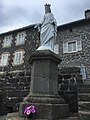 Statue of the Virgin Mary
 -
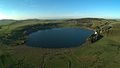 The lake of Saint-Front


See also
References
- ^ "Populations légales 2021". The National Institute of Statistics and Economic Studies. 28 December 2023.
Wikimedia Commons has media related to Saint-Front (Haute-Loire).
| Authority control databases: National |
|---|
This Haute-Loire geographical article is a stub. You can help Wikipedia by expanding it. |