Sarp Falls
| Sarp Falls | |
|---|---|
 Sarpefossen in May 2014 | |
 | |
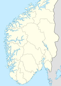
| Location | Viken county in southeastern Norway |
| Coordinates | 59°16′34.0″N 11°7′51.22″E / 59.276111°N 11.1308944°E |
| Total height | 20.5 m[1] |
| Average flow rate | 577 m³/s |
Sarp Falls[2][3][4] (Template:Lang-no or Sarpsfossen) is a waterfall at Sarpsborg in Viken, Norway.[1][5]
This is the last waterfall on the Glomma River, which is the longest river in Norway. Sarp Falls has one of the greatest flows of any waterfall in Europe. Both Rhine Falls and Dettifoss are larger and more powerful waterfalls in Europe but, while those waterfalls have between 200 and 500 m3/s (7,100 and 17,700 cu ft/s) of average water flow, Sarp Falls has approximately 577 m3/s (20,400 cu ft/s).[6] Just above Sarp Falls is a road bridge with a vista point. There are also vista points on the east side of the falls.
River surfing
Sarpebølgen (lit. the Sarp Wave) lies about 2-3 kilometers downstream from the Sarp Falls,[7][8][9] and is popular among kayakers and experienced surfers. The Norwegian Cup in Freestyle Paddling has been arranged here.[10] The wave is spectacular, since it is quite big in regards to river surfing. Experienced surfers have warned beginners from trying the wave, since there are strong currents which means one can easily be dragged far downstream.[11] The wave appears when the flow rate is above 800-900 m3/s. It is said that the wave is well suited for surfing on a surfboard at a flow rate from 1250 m3/s and up, and very well at around 1700 m3/s.[citation needed] Glommens og Laagens Brukseierforening provide freely available flow measurements of the river flow online.[12]
- Average water flow and temperature
| Place | Map | Jan | Feb | Mar | Apr | May | Jun | Jul | Aug | Sep | Oct | Nov | Dec | Unit |
|---|---|---|---|---|---|---|---|---|---|---|---|---|---|---|
| Sarp Wave | 59°15′55″N 11°06′14″E / 59.2653°N 11.1038°E | 1 | 1 | 1 | 3 | 8 | 13 | 16 | 16 | 12 | 7 | 3 | 1 | °C[13] |
| 500 | 470 | 390 | 500 | 1000 | 1100 | 850 | 650 | 550 | 570 | 520 | 510 | m3/s[14] |

Painting by Erik Pauelsen (1749–1790)
See also
References
- ^ a b Thorsnæs, Geir (March 7, 2017). "Sarpefossen". Store norske leksikon (in Norwegian). Foreningen Store norske leksikon.
- ^ Penn, James R. 2001. Rivers of the World: A Social, Geographical, and Environmental Sourcebook. Santa Barbara, CA: ABC CLIO, p. 94.
- ^ Gresswell, R. Kay. 1965. Standard Encyclopedia of the World's Rivers and Lakes. New York: Putnam, p. 105.
- ^ Sturluson, Snorri. 1990. Heimskringla, Or The Lives of the Norse Kings. New York: Dover, p. 647.
- ^ "Sarpefossen". Innovation Norway. Retrieved November 1, 2017.
- ^ Andersen, Pål (September 16, 2009). "Ny strøm fra Europas største foss". NRK. Retrieved November 22, 2017.
- ^ Fredriksstad Blad - Surf's up - i Glomma!
- ^ Fredriksstad Blad - Bølgesurf i Glomma
- ^ TV2.no - Her surfer Joel (45) på Glomma - Det er gode forhold for surfere i elva Glomma like ved Sarpefossen i disse dager.
- ^ Sarpsborg Arbeiderblad - Spektakulær padling i helga
- ^ Fredriksstad Blad - Østfolds Hawaii
- ^ Glommens og Laagens Brukseierforening - Sarpsfoss - Vannføring
- ^ Vanntemperatur (2008-2010) for Sarpsfoss, hentet fra RAPPORT L.NR. 6099-2010: Økologisk tilstand i Glomma nedenfor Sarpsfossen 2009-2010 - undersøkelser i forbindelse med Borregaards utslipp av organisk materiale
- ^ Statistikk for Sarpsfossen fra Eidsivaenergi: "Arkivert kopi". Archived from the original on 2012-03-30. Retrieved 2011-08-19.

