Jump to content

Kleaster Anjum

Coordinates: 53°13′52″N 5°36′50″E / 53.231°N 5.614°E / 53.231; 5.614
From Wikipedia, the free encyclopedia

This is an old revision of this page, as edited by TerraCyprus (talk | contribs) at 23:35, 5 October 2020 (top: clean up, replaced: | image → | image_skyline). The present address (URL) is a permanent link to this revision, which may differ significantly from the current revision.

Kleaster Anjum
Village
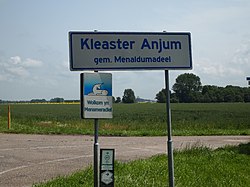
Kleaster Anjum Entrance
Map
CountryNetherlands Netherlands
ProvinceFriesland Friesland
Population
 • Totalc. 50

Kleaster-Anjum (Template:Lang-fry) is a hamlet in Waadhoeke in the province of Friesland, the Netherlands. It has a population of around 50.

53°13′52″N 5°36′50″E / 53.231°N 5.614°E / 53.231; 5.614