
Cedar Springs, Georgia
Cedar Springs, Georgia | |
|---|---|
 Cedar Springs | |
| Coordinates: 31°11′01″N 85°02′17″W / 31.18361°N 85.03806°W | |
| Country | United States |
| State | Georgia |
| County | Early |
| Area | |
| • Total | 2.978 sq mi (7.71 km2) |
| • Land | 2.978 sq mi (7.71 km2) |
| • Water | 0 sq mi (0 km2) |
| Elevation | 151 ft (46 m) |
| Population (2010) | |
| • Total | 74 |
| • Density | 25/sq mi (9.6/km2) |
| Time zone | UTC-5 (Eastern (EST)) |
| • Summer (DST) | UTC-4 (EDT) |
| ZIP code | 39832 |
| Area code | 229 |
| GNIS feature ID | 312495[2] |
Cedar Springs is a census-designated place and unincorporated community in Early County, Georgia, United States. Its population was 74 as of the 2010 census.[1] Cedar Springs has a post office with ZIP code 39832.[3] Georgia State Route 273 passes through the community. Georgia Pacific is 2 miles southwest from it.
The community was so named on account of a number of mineral springs near the original town site.[4]
References
- ^ a b "2010 Census Gazetteer Files - Places: Georgia". U.S. Census Bureau. Archived from the original on 2015-01-03. Retrieved January 2, 2015.
- ^ "Cedar Springs". Geographic Names Information System. United States Geological Survey, United States Department of the Interior.
- ^ United States Postal Service. "USPS - Look Up a ZIP Code". Retrieved January 2, 2015.
- ^ Krakow, Kenneth K. (1975). Georgia Place-Names: Their History and Origins (PDF). Macon, GA: Winship Press. p. 37. ISBN 0-915430-00-2.
Municipalities and communities of Early County, Georgia, United States | ||
|---|---|---|
| Cities | 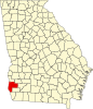 | |
| CDP | ||
| Unincorporated communities | ||
| Footnotes | ‡This populated place also has portions in an adjacent county or counties | |
This Early County, Georgia state location article is a stub. You can help Wikipedia by expanding it. |