
Rackett, Nebraska
Rackett, Nebraska | |
|---|---|
 Rackett Hall | |
 Rackett  Rackett | |
| Coordinates: 41°40′00″N 102°12′22″W / 41.66667°N 102.20611°W | |
| Country | United States |
| State | Nebraska |
| County | Garden |
| Elevation | 3,779 ft (1,152 m) |
| Time zone | UTC-7 (Mountain (MST)) |
| • Summer (DST) | UTC-6 (MDT) |
| Area code | 308 |
| GNIS feature ID | 832433[1] |
Rackett is an unincorporated community in Garden County, Nebraska, United States. Rackett is 19.3 miles (31.1 km) north-northeast of Oshkosh. Rackett Grange Hall No. 318, which is listed on the National Register of Historic Places, is located in Rackett.
A post office was established in Rackett in 1910, and remained in operation until it was discontinued in 1944.[2]
References
- ^ "Rackett". Geographic Names Information System. United States Geological Survey, United States Department of the Interior.
- ^ "Garden County". Jim Forte Postal History. Retrieved 9 August 2014.
Municipalities and communities of Garden County, Nebraska, United States | ||
|---|---|---|
| City | 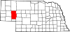 | |
| Village | ||
| CDP | ||
| Unincorporated communities | ||
This Garden County, Nebraska state location article is a stub. You can help Wikipedia by expanding it. |