Lípa (Havlíčkův Brod District)
Appearance
Lípa | |
|---|---|
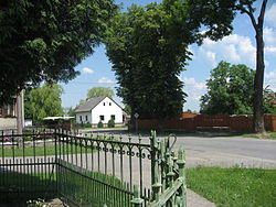
 Centre of Lípa | |
| Coordinates: 49°33′15″N 15°32′41″E / 49.55417°N 15.54472°E | |
| Country | |
| Region | Vysočina |
| District | Havlíčkův Brod |
| First mentioned | 1351 |
| Area | |
• Total | 14.70 km2 (5.68 sq mi) |
| Elevation | 505 m (1,657 ft) |
| Population (2020-01-01[1]) | |
• Total | 1,184 |
| • Density | 81/km2 (210/sq mi) |
| Time zone | UTC+1 (CET) |
| • Summer (DST) | UTC+2 (CEST) |
| Postal code | 580 01, 582 53, 582 57 |
| Website | obeclipa |
Lípa is a municipality and village in Havlíčkův Brod District in the Vysočina Region of the Czech Republic. It has about 1,200 inhabitants.
Administrative parts
Villages of Dálčice, Hostovlice, Jakubovice, Klášter, Košťany, Spytice, Ždánice and Zhoř are administrative parts of Lípa.
History
Lípa was first documented in 1351.
References
- ^ "Population of Municipalities – 1 January 2020". Czech Statistical Office. 30 April 2020.
Wikimedia Commons has media related to Lípa (Havlíčkův Brod District).


