
Lapoint, Utah
Lapoint, Utah | |
|---|---|
 Lapoint Location of Lapoint within the State of Utah  Lapoint Lapoint (the United States) | |
| Coordinates: 40°24′14″N 109°47′37″W / 40.40389°N 109.79361°W | |
| Country | United States |
| State | Utah |
| County | Uintah |
| Named for | Southward "point" of the Uinta Mountains |
| Elevation | 5,568 ft (1,697 m) |
| Time zone | UTC-7 (Mountain (MST)) |
| • Summer (DST) | UTC-6 (MDT) |
| ZIP codes | 84039 |
| GNIS feature ID | 1429476[1] |
Lapoint is an unincorporated community in western Uintah County, Utah, United States.[1]
Description
| Census | Pop. | Note | %± |
|---|---|---|---|
| 1930 | 579 | — | |
| 1940 | 646 | 11.6% | |
| 1950 | 496 | −23.2% | |
| Source: U.S. Census Bureau[2] | |||
The community lies along State Route 121, just inside the Uintah and Ouray Indian Reservation, and west of the city of Vernal (the county seat of Uintah County).[3] Deep Creek, a tributary of the Uinta River flow southwest through Lapoint.[4] The community's elevation is 5,568 feet (1,697 m).[1] Although Lapoint is unincorporated, it has a post office,[5] with the ZIP code of 84039.[6][7]
Originally named Taft in honor of William Howard Taft, its name was changed to Lapoint since it lies on a southward-jutting spur or "point" of the Uinta Mountains.[8][4]
Climate
According to the Köppen Climate Classification system, Lapoint has a semi-arid climate, abbreviated "BSk" on climate maps.[9]
Notable people
- Lane Frost (1963-1989), world champion professional rodeo bull rider, hall of fame inductee
- Shawn Bradley Shawn Paul Bradley is a German-American former professional basketball player who played center for the Philadelphia 76ers, New Jersey Nets and Dallas Mavericks of the National Basketball Association
See also
References
- ^ a b c "Lapoint". Geographic Names Information System. United States Geological Survey, United States Department of the Interior.
- ^ "Census of Population and Housing". United States Census Bureau. Archived from the original on 8 February 2006. Retrieved 4 Nov 2011.
- ^ Rand McNally. The Road Atlas '08. Chicago: Rand McNally, 2008, p. 103.
- ^ a b "MyTopo Maps - Lapoint, UT, USA" (Map). mytopo.com. Trimble Navigation, Ltd. Retrieved 11 Feb 2018.
- ^ "Find Locations: Lapoint". usps.com. United States Postal Service. Retrieved 11 Feb 2018.
- ^ "Look Up a ZIP Code: Default City Name in ZIP Code 84039". usps.com. United States Postal Service. Retrieved 11 Feb 2018.
- ^ Zip Code Lookup
- ^ Van Cott, John W. (1990). Utah Place Names: A Comprehensive Guide to the Origins of Geographic Names: A Compilation. Salt Lake City: University of Utah Press. p. 222. ISBN 978-0-87480-345-7. OCLC 797284427.
- ^ Climate Summary for Lapoint, Utah
External links
![]() Media related to Lapoint, Utah at Wikimedia Commons
Media related to Lapoint, Utah at Wikimedia Commons
Municipalities and communities of Uintah County, Utah, United States | ||
|---|---|---|
| Cities | 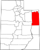 | |
| CDPs | ||
| Other communities | ||
| Indian reservation | ||
| Ghost town | ||
| Footnotes | ‡This populated place also has portions in an adjacent county or counties | |
| International | |
|---|---|
| National | |
This article about a location in Utah is a stub. You can help Wikipedia by expanding it. |