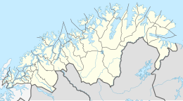
Melkøya
Native name: Muolkkut | |
|---|---|
 | |
| Geography | |
| Location | Troms og Finnmark, Norway |
| Coordinates | 70°41′24″N 23°35′56″E / 70.6900°N 23.5990°E |
| Area | 0.69 km2 (0.27 sq mi) |
| Length | 1.6 km (0.99 mi) |
| Width | 810 m (2660 ft) |
| Highest elevation | 71 m (233 ft) |
| Administration | |
Norway | |
| County | Troms og Finnmark |
| Municipality | Hammerfest Municipality |
Melkøya (Template:Lang-sme) is an island in Hammerfest Municipality in Troms og Finnmark county, Norway. The 0.69-square-kilometre (170-acre) island is connected to the town of Hammerfest (on the neighboring island of Kvaløya to the west) by the Melkøysund Tunnel which was completed in 2003.[1]
The industrial island is the endpoint of the undersea pipeline that transports natural gas from the Snøhvit natural gas fields in the Barents Sea. The gas goes through the 168-kilometre (104 mi) long pipeline to the processing plant Hammerfest LNG on Melkøya where it is converted into liquefied natural gas. The plant opened in 2007 and it is operated by Equinor.[1] Liquefied natural gas is then exported from Melkøya to world markets by a LNG gas carrier or tanker.
History
In 2001 and 2002, major archaeological investigations on Melkøya were undertaken before Statoil's development of the island began. The development of the island has changed Melkøya completely. On 21 August 2007, the gas from the Snøhvit field began flowing to Melkøya.
Media gallery
-
Evening view of the island
-
View in winter
-
View of the Hammerfest area, including Melkøya
-
View of the storage tanks
-
LPG tanker waiting to load liquefied natural gas at Melkøya.
See also
References
- ^ a b Store norske leksikon. "Melkøya" (in Norwegian). Retrieved 2013-01-31.


