
Olney, Oklahoma
Olney, Oklahoma | |
|---|---|
 Olney Location within the state of Oklahoma  Olney Olney (the United States) | |
| Coordinates: 34°28′21″N 96°21′40″W / 34.47250°N 96.36111°W | |
| Country | United States |
| State | Oklahoma |
| County | Coal |
| Elevation | 617 ft (188 m) |
| Time zone | UTC-6 (Central (CST)) |
| • Summer (DST) | UTC-5 (CDT) |
| GNIS feature ID | 1096264 |
Olney is an unincorporated community in Coal County, Oklahoma, United States.[1] It is located seven miles west of Lehigh.[2]
History
The community was founded by Eliphalet Nott and James Brooks Wright, who were the sons of Choctaw leader Allen Wright.[3] The community was originally named Parmicho, after the Choctaw words "pala misha," which mean "lighted place in the distance."[2] The name came from a lantern hanging at the railway station.[2] The town's name was changed to Olney on July 12, 1902.[2]
References
- ^ U.S. Geological Survey Geographic Names Information System: Olney, Oklahoma
- ^ a b c d Shirk, George. Oklahoma Place Names, 2nd ed. University of Oklahoma Press: Norman, Oklahoma. 1987. p.186.
- ^ Milligan, James C. "Coal County," Encyclopedia of Oklahoma History and Culture, Oklahoma Historical Society, Accessed July 1, 2015.
Municipalities and communities of Coal County, Oklahoma, United States | ||
|---|---|---|
| Cities | 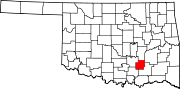 | |
| Towns | ||
| CDPs | ||
| Other communities | ||
| Indian reservations | ||
| Footnotes | ‡This populated place also has portions in an adjacent county or counties | |
This Oklahoma state location article is a stub. You can help Wikipedia by expanding it. |