Warnsveld
Appearance
Warnsveld | |
|---|---|
 Warnsveld, church | |
 | |
| Coordinates: 52°8′30″N 6°13′18″E / 52.14167°N 6.22167°E | |
| Country | Netherlands |
| Province | Gelderland |
| Municipality | Zutphen |
| Population | ca. 9,200 |
| Website | www.warnsveld.nl |
Warnsveld is a town in the eastern Netherlands, about 2 km east of Zutphen.
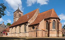
Warnsveld's Martinuskerk (Church of Saint Martin) was probably built as early as the 9th or 10th century. The first mention of the name Warnsveld in writing is from the year 1121.
Warnsveld was a separate municipality until 2005, when it was merged with Zutphen.[1] The former municipality had a population of about 9,000, and covered both the village of Warnsveld and nearby Warken.
People born in Warnsveld
- Richard Constant Boer (1863-1929), linguist
- Gert Holstege (born 1948), neuroscientist
- Ellen ten Damme (born 1967), singer & actor
- Anne-Wil Lucas-Smeerdijk (born 1975), politician
- Jan Werle (born 1984), chess player Grandmaster
- Thijs van Amerongen (born 1986), cyclo-cross cyclist
People died in Warnsveld
- Ida Gerhardt (1905-1997), poet
- Philip Kouwen (1922-2002), artist
Gallery
-
Windmill: korenmolen Nooit Gedacht
-
Country house Huis' t Velde (nowadays a police academy)
References
- ^ Ad van der Meer and Onno Boonstra, Repertorium van Nederlandse gemeenten, KNAW, 2011.
External links
52°09′N 6°14′E / 52.150°N 6.233°E


