
Miller, Kansas
Miller, Kansas | |
|---|---|
 | |
| Coordinates: 38°38′04″N 95°59′26″W / 38.63444°N 95.99056°W | |
| Country | United States |
| State | Kansas |
| County | Lyon |
| Elevation | 1,122 ft (342 m) |
| Time zone | UTC-6 (Central (CST)) |
| • Summer (DST) | UTC-5 (CDT) |
| ZIP code | 66868 |
| Area code | 785 |
| GNIS feature ID | 479282[1] |


Miller is an unincorporated community in Lyon County, Kansas, United States.
History
Miller was founded in 1910.[2]
The post office in Miller was discontinued in 1958.[3]
Geography
The climate in this area is characterized by hot, humid summers and generally mild to cool winters. According to the Köppen Climate Classification system, Miller has a humid subtropical climate, abbreviated "Cfa" on climate maps.[4]
Government
The nearest post office to Miller is in Osage City, because the post office in Reading was closed after their 2011 tornado. The mail is carried out of Lebo.
Education
The community is served by North Lyon County USD 251 public school district.
References
- ^ U.S. Geological Survey Geographic Names Information System: Miller, Kansas
- ^ French, Laura M. (1929). History of Emporia and Lyon County, Kansas. Heritage Books. p. 141.
- ^ "Kansas Post Offices, 1828-1961". Kansas Historical Society. Retrieved 10 June 2014.
- ^ Climate Summary for Miller, Kansas
Further reading
Municipalities and communities of Lyon County, Kansas, United States | ||
|---|---|---|
| Cities | 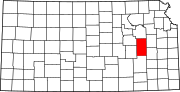 | |
| Unincorporated communities | ||
| Townships | ||
This article about a location in Lyon County, Kansas is a stub. You can help Wikipedia by expanding it. |