Jump to content

Crossford, South Lanarkshire

Coordinates: 55°42′00″N 3°52′15″W / 55.70000°N 3.87083°W / 55.70000; -3.87083
From Wikipedia, the free encyclopedia

This is an old revision of this page, as edited by Weatherman22 (talk | contribs) at 00:08, 7 December 2020 (Incorect postcode and post town was entered. https://checkmypostcode.uk/south-lanarkshire/crossford#.X81yHLOnwuU). The present address (URL) is a permanent link to this revision, which may differ significantly from the current revision.

Crossford
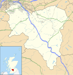
Crossford is located in South Lanarkshire
Crossford
Crossford
Location within South Lanarkshire
OS grid referenceNS826466
Council area
Lieutenancy area
CountryScotland
Sovereign stateUnited Kingdom
Post townCARLUKE
Postcode districtML8
PoliceScotland
FireScottish
AmbulanceScottish
UK Parliament
Scottish Parliament
List of places
UK
Scotland
55°42′00″N 3°52′15″W / 55.70000°N 3.87083°W / 55.70000; -3.87083

Crossford is a village in South Lanarkshire, Scotland.

Crossford lies on the A72, alongside the River Clyde and the River Nethan, 4.5 miles (7.2 km) north west of Lanark and 9 miles (14 km) south east of Hamilton. It is home to a pub, the Tillietudlem Inn, and a village shop. The nearest primary school, Underbank Primary, is situated just out of Crossford whilst the nearest secondary is in Carluke, though pupils from the village attend Lanark Grammar School. The 317 bus service runs every 90 minutes to Hamilton and Lanark.

External links