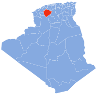
Tiaret District
Appearance
Tiaret District | |
|---|---|
 | |
| Country | |
| Province | Tébessa Province |
| Chief town | Tiaret |
| Area | |
| • Total | 43.03 sq mi (111.45 km2) |
| Population (2008) | |
| • Total | 201,263 |
| Time zone | UTC+1 (CET) |
Tiaret district is an Algerian administrative district located in the Province of Tiaret. Its chief town is located on the eponymous town of Tiaret.[1][2]
References
- ^ "Tiaret District". OpenStreetMap. OpenStreetMap. Retrieved 2 May 2018.
- ^ Negadi, M.; Hassani, A.; Ait Hammou, M; Dahmani, W.; et el (18 January 2018). "Diversity of Diatom epilithons and quality of water from the subbasin of Oued Mina (district of Tiaret, Algeria)". Ukrainian Journal of Ecology. 8 (1): 103–117. doi:10.15421/2018_194.

