Oud Ootmarsum
Appearance
Oud Ootmarsum | |
|---|---|
hamlet | |
| Nickname: Héénige Slépvént Land | |
 | |
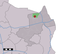
 The village (dark red) and the statistical district (light green) of Oud Ootmarsum in the municipality of Dinkelland. | |
| Coordinates: 52°25′0″N 6°55′0″E / 52.41667°N 6.91667°E | |
| Country | Netherlands |
| Province | Overijssel |
| Municipality | Dinkelland |
| Population | |
• Total | 340 |
| Demonym | Oud-Ootmarsumers |
| Time zone | UTC+1 (CET) |
| • Summer (DST) | UTC+2 (CEST) |
Oud Ootmarsum is a hamlet in the Dutch province of Overijssel. It is a part of the municipality of Dinkelland, and lies about 12 km north of Oldenzaal and very close to Ootmarsum.
The statistical area "Oud Ootmarsum", which also can include the surrounding countryside, has a population of around 340.[1]
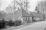
The partially timber framed building style of barns and farmhouses here is closely related to the building style of the Low German house.
Gallery
-
Old style barn
-
Old style barn
-
Old style farmhouse
-
Former watermill
References
- ^ Statistics Netherlands (CBS), Statline: Kerncijfers wijken en buurten 2003-2005. As of 1 January 2005.


