
Caballo, New Mexico
Caballo, New Mexico | |
|---|---|
Census-designated place | |
 Caballo, New Mexico | |
| Coordinates: 32°58′32″N 107°18′28″W / 32.97556°N 107.30778°W | |
| Country | United States |
| State | New Mexico |
| County | Sierra |
| Area | |
| • Total | 0.979 sq mi (2.54 km2) |
| • Land | 0.979 sq mi (2.54 km2) |
| • Water | 0 sq mi (0 km2) |
| Elevation | 4,252 ft (1,296 m) |
| Population | |
| • Total | 112 |
| • Density | 110/sq mi (44/km2) |
| Time zone | UTC-7 (Mountain (MST)) |
| • Summer (DST) | UTC-6 (MDT) |
| ZIP code | 87931 |
| Area code | 575 |
| GNIS feature ID | 898738[2] |
Caballo is a census-designated place in Sierra County, New Mexico, United States. Its population was 112 as of the 2010 census.[1] Caballo has a post office with ZIP code 87931.[3][4] The community is located along New Mexico State Road 187, north and south of Exit 63 on Interstate 25.
Caballo was founded in 1908, when John Gordon and his extended family homesteaded here. It was named after the mountains to the west. A post office was established in 1916. In 1938, the Caballo Dam was constructed, creating a lake which forced residents to re-establish the community to the west.[5]
Geography
Caballo is located at 32°58′50″N 107°18′27″W / 32.980625°N 107.307469°W. According to the U.S. Census Bureau, the CDP has an area of 0.979 square miles (2.54 km2), all land.[1] The area stretches for over five miles and includes an active fire department and many businesses, and residences. It borders Caballo Lake State Park.
References
- ^ a b c d "2010 Census Gazetteer Files - Places: New Mexico". U.S. Census Bureau. Archived from the original on 2014-07-14. Retrieved August 21, 2014.
- ^ "Caballo". Geographic Names Information System. United States Geological Survey, United States Department of the Interior.
- ^ "Postmaster Finder - Post Offices by ZIP Code". United States Postal Service. Retrieved August 21, 2014.
- ^ United States Postal Service. "USPS - Look Up a ZIP Code". Retrieved August 21, 2014.
- ^ Julyan, Robert (1996). The Place Names of New Mexico. University of New Mexico Press. p. 54. ISBN 0826316891.
External links
Municipalities and communities of Sierra County, New Mexico, United States | ||
|---|---|---|
| Cities | 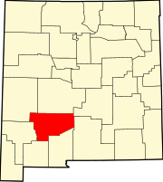 | |
| Villages | ||
| CDPs | ||
| Other communities | ||
| Ghost towns | ||
This New Mexico state location article is a stub. You can help Wikipedia by expanding it. |