Fegyvernek
Fegyvernek
Machæropolis (in Latin) | |
|---|---|
 Aerial view | |
| Coordinates: 47°16′N 20°32′E / 47.267°N 20.533°E | |
| Country | |
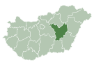
| County | Jász-Nagykun-Szolnok |
| District | Törökszentmiklós |
| Area | |
| • Total | 71.48 km2 (27.60 sq mi) |
| Population (2015) | |
| • Total | 6,447[1] |
| • Density | 90.2/km2 (234/sq mi) |
| Time zone | UTC+1 (CET) |
| • Summer (DST) | UTC+2 (CEST) |
| Postal code | 5231 |
| Area code | (+36) 56 |
| Website | www |
Fegyvernek is a town in Jász-Nagykun-Szolnok county, in the Northern Great Plain region of central Hungary.
Geography
It covers an area of 71.48 km2 (28 sq mi).
Population
It has a population of 6447 people (2015).[1]
References
- ^ a b Gazetteer of Hungary, 1 January 2015. Hungarian Central Statistical Office. 3 September 2015
External links
Wikimedia Commons has media related to Fegyvernek.
- Official website in Hungarian
47°16′N 20°32′E / 47.267°N 20.533°E


