Jump to content

Horcajo (Madrid)

Coordinates: 40°24′41″N 3°37′37″W / 40.41139°N 3.62694°W / 40.41139; -3.62694
From Wikipedia, the free encyclopedia

This is the current revision of this page, as edited by SuperSkaterDude45 (talk | contribs) at 18:49, 16 December 2020 (Undid revision 994598983 by Asqueladd (talk) This is escalating into a edit war, I'd advise you to stop since I am not in the mood and I won't hesitate to request Page Protection what talkpage? You have no reason to delete them other than because you simply want to. If you want consensus, here: https://en.wikipedia.org/wiki/Wikipedia:Manual_of_Style/Icons#Flags Revert one more time and I will report your unjustified reverts.). The present address (URL) is a permanent link to this version.

(diff) ← Previous revision | Latest revision (diff) | Newer revision → (diff)
Horcajo
Location of Horcajo
CountrySpain Spain
Region Community of Madrid
Municipality Madrid
DistrictMoratalaz
Area
 • Total
0.745503 km2 (0.287840 sq mi)
Population
 (2020)
 • Total
6,453
 • Density8,700/km2 (22,000/sq mi)

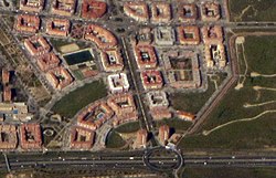
Horcajo is an administrative neighborhood (barrio) of Madrid belonging to the district of Moratalaz. It has an area of 0.745503 km2 (0.287840 sq mi).[1] As of 1 February 2020, it has a population of 6,453.[2]

References

[edit]
  1. ^ "Callejero vigente. Barrios". Ayuntamiento de Madrid.
  2. ^ "Población por distrito y barrio". Ayuntamiento de Madrid. Retrieved 11 March 2020.

40°24′41″N 3°37′37″W / 40.41139°N 3.62694°W / 40.41139; -3.62694