Solgohachia, Arkansas
Appearance
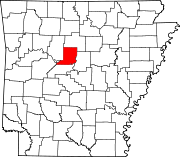
Solgohachia (pronounced saw-guh-HATCH-ee [1]) is an unincorporated community in Conway County, Arkansas, United States, about 10 miles (16 km) north of Morrilton on state highway 9 and Highway 287. The name is from the Choctaw word Sok-ko-huch-cha, meaning "muscadine river" (Cushman, p. 603).
Even though it is an unincorporated community, Shannon Oakley was appointed "Mayor" of Solgohachia.
Nearby Solgohachia Bridge was listed on the National Register of Historic Places on May 26, 2004. Unfortunately the old steel span bridge no longer exists. [citation needed] The creek it spanned is Point Remove Creek.
[2]
Further reading
- Horatio Bardwell Cushman. (1899). History of the Choctaw, Chickasaw, and Natchez Indians. Greenville, Texas: Headlight Printing House.
External links
- Map: 35°15′22″N 92°40′35″W / 35.25611°N 92.67639°W
- "Solgohachia". Geographic Names Information System. United States Geological Survey. Retrieved 2012-12-30.

