Arnuero
Appearance
You can help expand this article with text translated from the corresponding article in Spanish. (December 2015) Click [show] for important translation instructions.
|
Arnuero | |
|---|---|
 Isla and Isla Playa, Arnuero | |
 | |
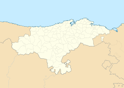
Location within Cantabria | |
| Coordinates: 43°28′23″N 3°33′47″W / 43.47306°N 3.56306°W | |
| Country | |
| Autonomous community | |
| Province | |
| Comarca | Trasmiera |
| Judicial district | Santoña |
| Capital | Arnuero |
| Government | |
| • Alcalde | José Manuel Igual Ortiz (2007) (PP) |
| Area | |
• Total | 24.66 km2 (9.52 sq mi) |
| Elevation | 24 m (79 ft) |
| Population (2018)[1] | |
• Total | 2,108 |
| • Density | 85/km2 (220/sq mi) |
| Time zone | UTC+1 (CET) |
| • Summer (DST) | UTC+2 (CEST) |
| Postal code | 39195 |
| Website | Official website |
Arnuero is a municipality in the province and autonomous community of Cantabria, northern Spain.
The municipality is located in the northeastern portion of the province, and includes three small villages : Arnuero, Soano and Isla. Isla has two seaside districts, popular tourism destinations, Quejo (Cape Quejo) and Playa la Arena.
Towns
- Arnuero (Capital)
- Castillo Siete Villas
- Isla e Isla Playa
- Soano
References
- ^ Municipal Register of Spain 2018. National Statistics Institute.
External links


