Schwarzsee
Appearance
| Schwarzsee Lac Noir | |
|---|---|
 | |
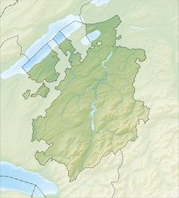
| Location | Canton of Fribourg |
| Coordinates | 46°39′55″N 7°16′50″E / 46.66528°N 7.28056°E |
| Primary inflows | Euschelsbach, Seeweidbach |
| Primary outflows | Warme Sense |
| Basin countries | Switzerland |
| Max. length | 1.4 km (0.87 mi) |
| Max. width | 0.5 km (0.31 mi) |
| Surface area | 0.47 km2 (0.18 sq mi) |
| Max. depth | 10 m (33 ft) |
| Surface elevation | 1,046 m (3,432 ft) |
| Settlements | Plaffeien |
| Website | https://www.schwarzsee.ch |
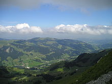
Schwarzsee or Lac Noir (Template:Lang-en)[1][2][3] (German: Schwarzsee), (French: Lac Noir or rarely Lac Domène), is a small lake in the Canton of Fribourg, Switzerland with an area of 0.47 km2 (0.18 sq mi). The lake in the Swiss Prealps is bordered by the peaks of Schwyberg (1,628 m) in the West, Les Reccardets (1,923 m) and Spitzfluh (1,951 m) in the South, as well as Kaiseregg (2,185 m).


See also
References
- ^ Tissot, Victor. 2007. Unknown Switzerland. New York: A. D. F. Randolph & Co., p. 346.
- ^ Michelin Tyre Public Limited Company. 2001. Switzerland. London: News Chronicle Book Department, p. 148.
- ^ Switzerland Tourism. 2017. Schwarzsee, Fribourg Region.
External links
 Media related to Schwarzsee, lake in Fribourg at Wikimedia Commons
- Schwarzsee.ch (in English, German, and French) tourism information
- Schwarzsee in German, French and Italian in the online Historical Dictionary of Switzerland.

