
El Gogorrón National Park
Gogorrón National Park is protected natural area in the state San Luis Potosí, Mexico.
The size of the protected area is 250 km².[1] The park is surrounded by the elevations in the Sierras de Bernalejo and La Cuesta and the nearby Altamira River. The name of the area is coming from Hacienda El Gogorrón, who made this place a resort. In 22 September 1936 the area becomes a protected area and national park.[2]
Flora and Fauna
Flora
Representatives of species: Pinion (Pinus cembroides), Pine (Pinus montezumae), Encino (Quercus intricata), Oak (Quercus polymorpha), Encino (Quercus rugosa), Encino (Quercus diversifolia), (Quercus potosina), Nopal (Opuntia spp.).
Fauna
Representatives of species: Black-tailed Rattlesnake (Crotalus molossus), Wild Duck (Anas platyrhynchos), Tecolote pocero (Athene cunicularia), White-tailed deer (Odocoileus virginianus).[3]
-

-
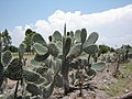 Cactuses in the park
 -
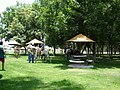 Horse Riding in Gogorrón National Park


References
- ^ "Ficha General de Área". web.archive.org. 2012-11-01. Retrieved 2020-01-29.
- ^ Parque Nacional El Gogorrón en San Luis Potosí turimexico.com/
- ^ Ficha SIMEC | Comisión Nacional de Áreas slp.gob.mx