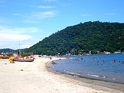
Mangaratiba
Mangaratiba | |
|---|---|
Municipality | |
| Município de Mangaratiba | |
 Itacuruçá | |
 Location of Mangaratiba in the state of Rio de Janeiro | |
| Coordinates: 22°57′36″S 44°02′27″W / 22.96000°S 44.04083°W | |
| Country | |
| Region | Southeast |
| State | |
| Government | |
| • Prefeito | Aarão de Moura Brito Neto (PPS) |
| Area | |
| • Total | 356.408 km2 (137.610 sq mi) |
| Elevation | 355 m (1,165 ft) |
| Population (2010) | |
| • Total | 36,456 |
| Time zone | UTC-3 (UTC-3) |
| Website | [1] |
Mangaratiba (Portuguese pronunciation: [mɐ̃gaɾɐˈtʃibɐ]) is a municipality located in the Brazilian state of Rio de Janeiro. Its population is 29,272 (2005) and its area is 352 km².[1]
Part of the Sylvester Stallone film The Expendables was shot in the central part of the city. The pier that is exploded in the film is the pier that the main ferry to Ilha Grande uses as its base of operation.
Many large bulk carriers enter the port of Mangaratiba, fetching heavy loads of iron ore bound for especially European ports. As such, the port of Mangaratiba is one of the largest in Brazil.[citation needed]
References
- ^ IBGE - "Archived copy". Archived from the original on 2007-01-09. Retrieved 2007-01-09.
{{cite web}}: CS1 maint: archived copy as title (link)


