
Medvednik
| Medvednik | |
|---|---|
 Medvednik Location in Serbia | |
| Highest point | |
| Elevation | 1,247 m (4,091 ft)[1] |
| Coordinates | 44°12′37″N 19°38′12″E / 44.21028°N 19.63667°E |
| Geography | |
| Location | Western Serbia |
| Parent range | Dinaric Alps |
Medvednik[2] (Serbian Cyrillic: Медведник) is a mountain in western Serbia, near the town of Valjevo. Its highest peak has an elevation of 1,247 meters above sea level.
-
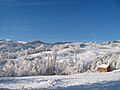
 Mountain Medvednik in winter
 -
 Mountain Medvednik in winter
 -
 Mountain Medvednik in winter
 -
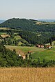
 Mountain Medvednik, village Rebelj
 -
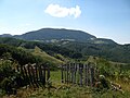
 West side of the mountain Medvednik
 -
 West side of the mountain Medvednik
 -
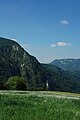
 West side of the mountain Medvednik and the mountain Orovica
 -
 Village Rebelj - Mountain Lodge
 -
 West side of the mountain Medvednik - Place Kozila
 -
 Mountain Medvednik - village Drenaic
 -
 Top of the mountain Medvednik
 -
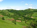
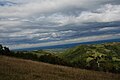
 Mountain Medvednik in summer
 -
 Mountain Medvednik in summer - village Rebelj
 -
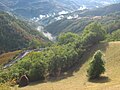 The surroundings of rivers Rebelj, Mala reka and Velika reka
 -
 Village Rebelj in autumn
 -
 Mountain Medvednik in autumn
 -
 Mountain Medvednik in autumn
 -
 The river Kolubara valley
 -
 The Zavojsnica river
 -
 The Zavojsnica river
 -
 The ethno complex Bebica Luka in winter
 -
 The ethno complex Bebica Luka in summer
 -
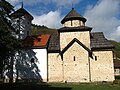 The monastery Pustinja

_-_Detalj.jpg)


References
- ^ Jovan Đokić. "Katalog planina Srbije". PSD Kopaonik Beograd. Archived from the original on May 18, 2011.
- ^ "Medvednik". Valjevski turistički info centar. Archived from the original on 2011-07-22. Retrieved 2010-10-18.
This Serbia location article is a stub. You can help Wikipedia by expanding it. |