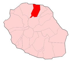
Sainte-Marie, Réunion
Sainte-Marie | |
|---|---|
 The town hall of Sainte-Marie | |
 | |
| Coordinates: 20°53′49″S 55°32′57″E / 20.8969°S 55.5492°E | |
| Country | France |
| Overseas region and department | Réunion |
| Arrondissement | Saint-Denis |
| Canton | Sainte-Marie |
| Intercommunality | Nord de la Réunion |
| Government | |
| • Mayor (2014-2020) | Jean-Louis Lagourgue |
| Area 1 | 87.21 km2 (33.67 sq mi) |
| Population (2021)[1] | 34,344 |
| • Density | 390/km2 (1,000/sq mi) |
| Time zone | UTC+04:00 |
| INSEE/Postal code | 97418 /97438 |
| Elevation | 0–1,800 m (0–5,906 ft) (avg. 5 m or 16 ft) |
| 1 French Land Register data, which excludes lakes, ponds, glaciers > 1 km2 (0.386 sq mi or 247 acres) and river estuaries. | |
Sainte-Marie is a commune in the French overseas department of Réunion. It is located on the north side of the island of Réunion, just east of, and adjacent to, the capital of Saint-Denis.

Transport & Economy
Reunion's main airport and the Air Austral headquarters are located in Sainte-Marie.[2][3][4] There is also a small fishing harbour, a shopping-center and a brewery in the commune.
Sister cities
 Moka Flacq, (Mauritius), since 1992[5]
See also
References
- ^ "Populations légales 2021". The National Institute of Statistics and Economic Studies. 28 December 2023.
- ^ World Airline Directory. Flight International. 1–7 April 1998. "40.
- ^ "Géographie Archived 2009-06-04 at the Wayback Machine." Sainte-Marie. Retrieved on 7 October 2009.
- ^ "Mentions légales Archived 2009-12-29 at the Wayback Machine." Air Austral. Retrieved on 7 October 2009.
- ^ - City of Ste.Marie Jumelages (in French)
External links
- Official website (in French)
Wikimedia Commons has media related to Sainte-Marie (Réunion).


