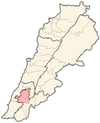
Doueir
Doueir
دوير | |
|---|---|
City | |
| Coordinates: 33°23′11″N 35°24′52″E / 33.38639°N 35.41444°E | |
| Grid position | 120/161 L |
| Country | |
| Governorate | Nabatieh Governorate |
| District | Nabatieh District |
| Government | |
| • Mayor | mohammad kanso |
| Area | |
| • Total | 10 km2 (4 sq mi) |
| Elevation | 420 m (1,380 ft) |
| Time zone | UTC+2 (EET) |
| • Summer (DST) | UTC+3 (EEST) |
| Dialing code | +961 |
Doueir (Arabic: دوير, ad-Duwayr), or Dweir, is a village of 7,500 inhabitants in Southern Lebanon near Nabatieh, and north of the Litani River. It is located directly next to the village of Charkiyeh. Although Doueir is considered a big village, it is the home of many well-known Lebanese such as former Labour minister Ali Qanso, and the late physics scientist Rammal Rammal.
History
[edit]In 1875 Victor Guérin found it to be a large village with 800 Metuali inhabitants.[1]
During the 2006 Lebanon War, Doueir was among the first targets of the Israel Defense Forces, with a family of 12 killed on July 13.[2][3][4] The village has since benefited from investment by the Italian government to build a new olive oil mill.[5]
Demographics
[edit]In 2014 Muslims made up 99,35% of registered voters in Doueir. 97,43% of the voters were Shiite Muslims.[6]
References
[edit]- ^ Guérin, 1880, pp. 530-531
- ^ Report of the Commission of Inquiry on Lebanon pursuant to Human Rights Council resolution S-2/1 Archived June 17, 2013, at the Wayback Machine
- ^ Blanford, Nicholas; Stephen Farrell (July 14, 2006). "Two sides — one war". The Times. London. Retrieved 14 January 2009.[dead link]
- ^ Commission of Inquiry on Lebanon - Attacks on civilians and civilian objects - Doueir Archived February 12, 2012, at the Wayback Machine
- ^ "Italy funds new olive mill, generator in southern town". Daily Star (Lebanon). 26 August 2008. Retrieved 14 January 2009.
- ^ https://lub-anan.com/المحافظات/النبطية/النبطية/الدوير/المذاهب/
Bibliography
[edit]- Guérin, V. (1880). Description Géographique Historique et Archéologique de la Palestine (in French). Vol. 3: Galilee, pt. 2. Paris: L'Imprimerie Nationale.


