Ait Baha
Ait Baha
آيت باها ⴰⵢⵜ ⴱⴰⵀⴰ | |
|---|---|
Town | |
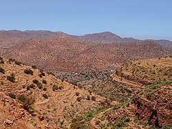
 The Anti-Atlas South of Ait Baha, on the road to Tafraout | |
| Country | |
| Region | Souss-Massa |
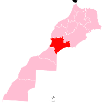
| Province | Chtouka Aït Baha Province |
| Population (2004) | |
| • Total | 4,767 |
| Time zone | UTC+0 (WET) |
| • Summer (DST) | UTC+1 (WEST) |
Wikimedia Commons has media related to Ait Baha.
Ait Baha (in tifinagh : ⴰⵢⵜ ⴱⴰⵀⵔⴰ) is a town in Chtouka Aït Baha Province, Souss-Massa, Morocco. According to the 2004 census it has a population of 4,767.[1]

