Allondon
Appearance
| Allondon | |
|---|---|
 | |
 | |
| Location | |
| Countries | France, Switzerland |
| Physical characteristics | |
| Mouth | |
• location | Rhône |
| Length | 22.5 km (14.0 mi) |
| Basin size | pluvial |
| Discharge | |
| • average | 2.5 m3/s (88 cu ft/s) |
| Basin features | |
| Progression | Rhône→ Mediterranean Sea |
The Allondon is a river which flows for some 22 kilometres (14 mi) between France and Switzerland in the Rhône Alps area. Its source is located in the commune of Échenevex in the Ain department and ends in the river Rhône at the village of Russin in the canton of Geneva of Switzerland. It is home to the only recently known population of the rare insect Lachesilla rossica.
-
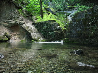
The source of the Allondon River in Échenevex
External links
 Media related to Allondon at Wikimedia Commons
46°10′N 6°01′E / 46.167°N 6.017°E


