Almannaskarðsgöng
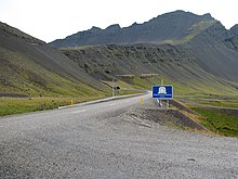
 Southwestern entrance | |
| Overview | |
|---|---|
| Location | Hornafjörður, Iceland |
| Route | 1 |
| Operation | |
| Work begun | 2004 |
| Operator | Vegagerðin |
| Traffic | Automotive |
| Vehicles per day | 300 |
| Technical | |
| Length | 1.3 km (0.81 mi) |
| No. of lanes | 2 |
| Highest elevation | 82 m (269 ft) |
| Lowest elevation | 39 m (128 ft) |
| Grade | 4.6% |
Almannaskarðsgöng is a tunnel along Route 1, located near Höfn (Hornafjörður) in Eastern Region in eastern Iceland. The tunnel measures exactly 1312 metres in length (although the sign rounds it off to 1300) and was opened on June 24, 2005. The tunnel passes under the narrow and steep pass Almannaskarð, between Hornafjörður and Lón district. The pass is still accessible in the summer time from the northern ramp (the southwest ramp is closed for public traffic), and there is a parking place with a beautiful view.

During the winter the road had to be closed because of regular snow, blocking traffic to and from the east of Iceland, so a new tunnel began construction in March 2004 and was completed in October 2004.[1] The tunnel runs through 1150 metres of solid rock and some 162 metres of concrete portals, bringing the total length to 1312 metres. The road is two lanes wide, although there are three passing places in the tunnel for emergency traffic. The southern tunnel entrance is located at 39 metres above sea level whilst the northern tunnel entrance is located at 82 metres to the north, making the incline of the tunnel 4.6%.
References
- ^ "News from Iceland". News from Iceland - Review Journal. June 2005. Retrieved November 3, 2010.
64°16′57″N 15°2′21″W / 64.28250°N 15.03917°W
