Contingency Operating Site Garry Owen
This article includes a list of general references, but it lacks sufficient corresponding inline citations. (March 2016) |
| Amarah Air Base | |
|---|---|
| Coordinates | 31°49′11″N 047°04′51″E / 31.81972°N 47.08083°E |
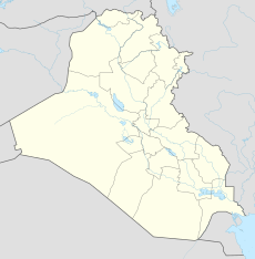
Amarah Air Base is a former Iraqi Air Force base in the Maysan Governorate of Iraq. It was captured by Task Force Tarawa, United States Marine Corps on 8 March 2003, during the 2003 invasion of Iraq.[1] After the invasion it was used by British Army logistics units.[2]
Overview
The faculty was a primary air base for the Iraqi Air Force prior to the 2003 invasion. It had a 10,000 foot runway with numerous taxi-ways leading right out of Hardened Aircraft Shelters (HAS) and laid diagonally to the runways - known as "Trapezoids" or "Yugos". It was a large, expansive base, it is undetermined if it contains underground facilities for aircraft sheltering.
It was apparently abandoned after Operation Desert Storm in March 1991, its proximity to the Kuwaiti border making it unsuitable for use by the Iraqi Air Force. After the initial U.S./British invasion in 2003, it was used by British Forces as "Camp Condor".
Today, the main runway appears to be undamaged and most of the taxi-ways are also in serviceable condition. The structures at the base appear to be abandoned and badly deteriorated.
See also
References
- ^ Anthony Tucker-Jones, Operation Iraqi Freedom: Iraq 2003.
- ^ "Operation Telic: British Forces Deployed". Britain's Small Wars. Archived from the original on 20 August 2014. Retrieved 17 November 2013.
{{cite web}}: Unknown parameter|deadurl=ignored (|url-status=suggested) (help)

