Andvord Bay

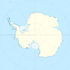
Andvord Bay (64°50′S 62°39′W / 64.833°S 62.650°W) is a bay 9 nautical miles (17 km) long and 3 nautical miles (6 km) wide, which lies between Beneden Head and Duthiers Point along the west coast of Graham Land.
It was discovered by the Belgian Antarctic Expedition, 1897–99, under Adrien de Gerlache, and named by him for Rolf Andvord, Belgian consul at Christiania (Oslo) at that time.[1]
A popular cruise-ship destination is Neko Harbour, which was discovered by Belgian explorer Adrien de Gerlache in the early 20th century. It was named for a Scottish whaling boat, the Neko, which operated in the area between 1911 and 1924.
References
- ^ "Andvord Bay". Geographic Names Information System. United States Geological Survey, United States Department of the Interior. Retrieved 2011-05-11.
![]() This article incorporates public domain material from "Andvord Bay". Geographic Names Information System. United States Geological Survey.
This article incorporates public domain material from "Andvord Bay". Geographic Names Information System. United States Geological Survey.

