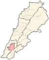
Arabsalim
Appearance
Arabsalim
عرب صاليم Aarab Salim | |
|---|---|
Village | |
 Arabsalim, 2008 | |
| Coordinates: 33°25′44″N 35°30′59″E / 33.42889°N 35.51639°E | |
| Grid position | 129/165 L |
| Country | |
| Governorate | Nabatieh Governorate |
| District | Nabatieh District |
| Time zone | UTC+2 (EET) |
| • Summer (DST) | +3 |
Arabsalim (Arabic: عرب صاليم) is a populated area in Nabatiyeh District, in southern Lebanon.
Location
Arabsalim is located 87 km from Beirut, at an altitude of 560 meters.[1]
History
The town’s name, which comes from the Phoenician language, also appears in Pharaonic records as Rab Salim or “the god of peace.” Found here is a shrine to the prophet Salim, which has important archeological significance.[2]
See also
References
- ^ *Aarab Salim, Localiban
- ^ "Wayback Machine" (PDF). 2006-07-16. Retrieved 2018-08-15.
External links
- Aarab Salim, Localiban


