Arasvikfjord
Appearance
| Arasvikfjorden | |
|---|---|
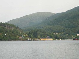
 View of the fjord at Vågosen | |
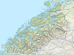
Location in Møre og Romsdal | |
| Location | Nordmøre, Møre og Romsdal |
| Coordinates | 63°09′13″N 8°27′04″E / 63.15361°N 8.45111°E |
| Basin countries | Norway |
| Max. length | 12 kilometres (7.5 mi) |
Arasvikfjord or Arasvikfjorden (Template:Lang-en)[1][2] is a fjord in Møre og Romsdal county, Norway. The fjord is located between Aure Municipality and Halsa Municipality in the Nordmøre region of the county. The fjord is part of the larger Vinjefjorden, near where the Valsøyfjorden branches off to the south. European route E39 runs along the south shore of the fjord, through the village of Valsøyfjord. The ferry from Hennset to Arasvika crosses the fjord. The Arasvikfjorden is known for its fishery of cod, coalfish, pollock, mackerel, common ling, tusk, catfish, and several types of flatfish.[3]
See also
References
- ^ Sailing Directions for the Northwest and North Coasts of Norway. 1931. Washington, DC: U.S. Government Printing Office, p. 137.
- ^ Map of Arasvik Fjord in Møre og Romsdal, Norway.
- ^ "Arasvikfjorden" (in Norwegian). yr.no. Retrieved 2010-12-10.

