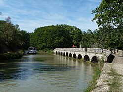
Argent-Double Aqueduct
Appearance
Pont-canal de l'Argent-Double | |
|---|---|
 Argent-Double Aqueduct | |
| Coordinates | 43°15′04.00″N 2°39′58.27″E / 43.2511111°N 2.6661861°E |
| Carries | Canal du Midi |
| Crosses | Argent-Double River |
| Locale | La Redorte |
| Location | |
 | |
The Argent-Double Aqueduct (Template:Lang-fr) is one of several aqueducts on the Canal du Midi. The Argent-Double stream is culverted under the canal at La Redorte.[1]
Gallery
-
Looking down to the Argent-Double stream
-
From the stream
See also
References
- ^ Rolt, L. T. C. (1973). From Sea to Sea. Ohio University Press. ISBN 8124-0152-1.
{{cite book}}: Check|isbn=value: length (help); Cite has empty unknown parameter:|coauthors=(help)


