Armington, Montana
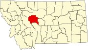
Armington, Montana is a village in Cascade County, Montana near the town of Belt, Montana.
Geography
Latitude: 47.366165
Longitude: -110.902289
History
Armington has a history of being a commercial hub for Farmers, Ranchers, Miners and others living in the surrounding areas of Cascade County. It is often referred to as Armington Junction because it is near where Armington Road meets U.S. Highway 89 and U.S. Highway 87.
Armington is named after the rancher Doc Armington.
Recreation
Armington offers access to the Kings Hill Scenic Byway, Sluice Boxes State Park, Showdown Ski Area as well as Belt Butte and Belt Creek for hiking and fishing activities.
Camping is available and Essential Services are provided in the nearby town of Belt Montana. Armingtons founder was Hezakiah Armington. He also founded the only other Armington in America Armington Il
References
1 Cascade County Chamber of Commerce.

