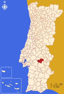
Arraiolos
Arraiolos | |
|---|---|
Settlement | |
 | |
| Coordinates: 38°43′N 7°59′W / 38.717°N 7.983°W | |
| Country | |
| Region | Alentejo |
| Intermunic. comm. | Alentejo Central |
| District | Évora |
| Area | |
| • Total | 683.75 km2 (264.00 sq mi) |
| Population (2011) | |
| • Total | 7,363 |
| • Density | 11/km2 (28/sq mi) |
| Time zone | UTC±00:00 (WET) |
| • Summer (DST) | UTC+01:00 (WEST) |
| Website | http://www.cm-arraiolos.pt |
Arraiolos (Portuguese pronunciation: [ɐʁɐˈjɔluʃ]) is a municipality in Évora District in Portugal. The population in 2011 was 7,363,[1] in an area of 683.75 km².[2] The town of Arraiolos has 3,351 inhabitants. The present Mayor is Silvia Pinto, elected by the Unitarian Democratic Coalition.
The town is famous for its castle and its embroidered wool rugs and carpets. Arraiolos rugs have been made since the Middle Ages.[3]
In October 2003, Jorge Sampaio, the then President of Portugal, invited the Presidents of Finland, Germany, as well as of soon-to-be EU members Hungary, Latvia and Poland to Arraiolos in order to discuss the consequences of the 2004 enlargement of the European Union and plans for a Constitution for Europe.[4] Subsequent meetings of non-executive presidents of European Union member states have been dubbed Arraiolos meetings.
History
A hoard of prehistoric objects, including a trapezoid-shaped plaque with geometric design and three pottery vessels, was excavated from a tumulus or barrow in Arraiolos at the beginning of the twentieth century. They are now kept at the British Museum.[5]
See also
- Vendas Novas for similar hoard
Parishes
Administratively, the municipality is divided into 5 civil parishes (freguesias):[6]
- Arraiolos
- Gafanhoeira e Sabugueiro
- Igrejinha
- São Gregório e Santa Justa
- Vimieiro
-
The local castle.
-
View of the countryside from the castle.
-
A house in Arraiolos.
References
- ^ Instituto Nacional de Estatística
- ^ Direção-Geral do Território[permanent dead link]
- ^ Fleming, John & Hugh Honour. (1977) The Penguin Dictionary of Decorative Arts. London: Allen Lane, p. 35. ISBN 0713909412
- ^ "Foreign Policy Events, 13-20 October 2003". Ministry of Foreign Affairs (Latvia). Retrieved 5 October 2013.
- ^ British Museum Collection
- ^ Diário da República. "Law nr. 11-A/2013, page 552 19" (pdf) (in Portuguese). Retrieved 16 July 2014.
External links
 Media related to Arraiolos at Wikimedia Commons
- Town Hall official website
- Photos of ARRAIOLOS


