
Assemblée Nationale station
Assemblée Nationale | |||||||||||
|---|---|---|---|---|---|---|---|---|---|---|---|
| Paris Métro station | |||||||||||
 | |||||||||||
| General information | |||||||||||
| Location | 7th arrondissement of Paris Île-de-France France | ||||||||||
| Coordinates | 48°51′38″N 2°19′16″E / 48.860655°N 2.32113°E | ||||||||||
| Owned by | RATP | ||||||||||
| Operated by | RATP | ||||||||||
| Other information | |||||||||||
| Fare zone | 1 | ||||||||||
| History | |||||||||||
| Opened | 5 November 1910 | ||||||||||
| Rebuilt | 2018 | ||||||||||
| Services | |||||||||||
| |||||||||||
| |||||||||||

Assemblée Nationale is a station on Line 12 of the Paris Métro in the 7th arrondissement, named after the nearby French National Assembly.
The station opened on 5 November 1910 as part of the original section of the Nord-Sud Company's line A between Porte de Versailles and Notre-Dame-de-Lorette. On 27 March 1931 line A became line 12 of the Métro. It was called Chambre des Députés ("Chamber of Deputies", the former name of the French National Assembly) until 1989.
Station layout
| Street Level |
| B1 | Mezzanine |
| Line 12 platforms | Side platform, doors will open on the right | |
| Southbound | ← | |
| Northbound | | |
| Side platform, doors will open on the right | ||
Gallery
-
 Street-level entrance at Assemblée Nationale
 -
 MF 67 rolling stock on Line 12 at Assemblée Nationale
 -
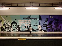
 2008 exhibition on political themes at Assemblée Nationale
 -
 2008 exhibition on political themes at Assemblée Nationale


Wikimedia Commons has media related to Assemblée nationale (Paris Metro).
References
- Roland, Gérard (2003). Stations de métro. D’Abbesses à Wagram. Éditions Bonneton.