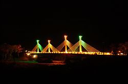
Assis Brasil
Appearance
10°56′27″S 69°34′01″W / 10.94083°S 69.56694°W
Assis Brasil | |
|---|---|
 | |
 Location of municipality in Acre State | |
| Country | |
| State | Acre |
| Area | |
• Total | 1,110 sq mi (2,876 km2) |
| Population (2007) | |
• Total | 5,351 |
Assis Brasil is a municipality located in the south of the Brazilian state of Acre. Its population is 5351 (as of 2007) and its area is 2,876 square kilometres (1,110 sq mi).
The municipality contains part of the Rio Acre Ecological Station.[1] It also contains part of the 931,537 hectares (2,301,880 acres) Chico Mendes Extractive Reserve, a sustainable use environmental unit created in 1990.[2]
Towns and villages
- Abismo
- Assis Brasil - capital
- Maloca
- Reserva Extrema
- São Francisco, Acre
- Senegal, Acre
- Seringal Paraguacu
References
- ^ Unidade de Conservação: Estação Ecológica Rio Acre (in Portuguese), MMA: Ministério do Meio Ambiente, retrieved 2016-04-23
- ^ Unidade de Conservação: Reserva Extrativista Chico Mendes (in Portuguese), MMA: Ministério do Meio Ambiente, retrieved 2016-06-04

